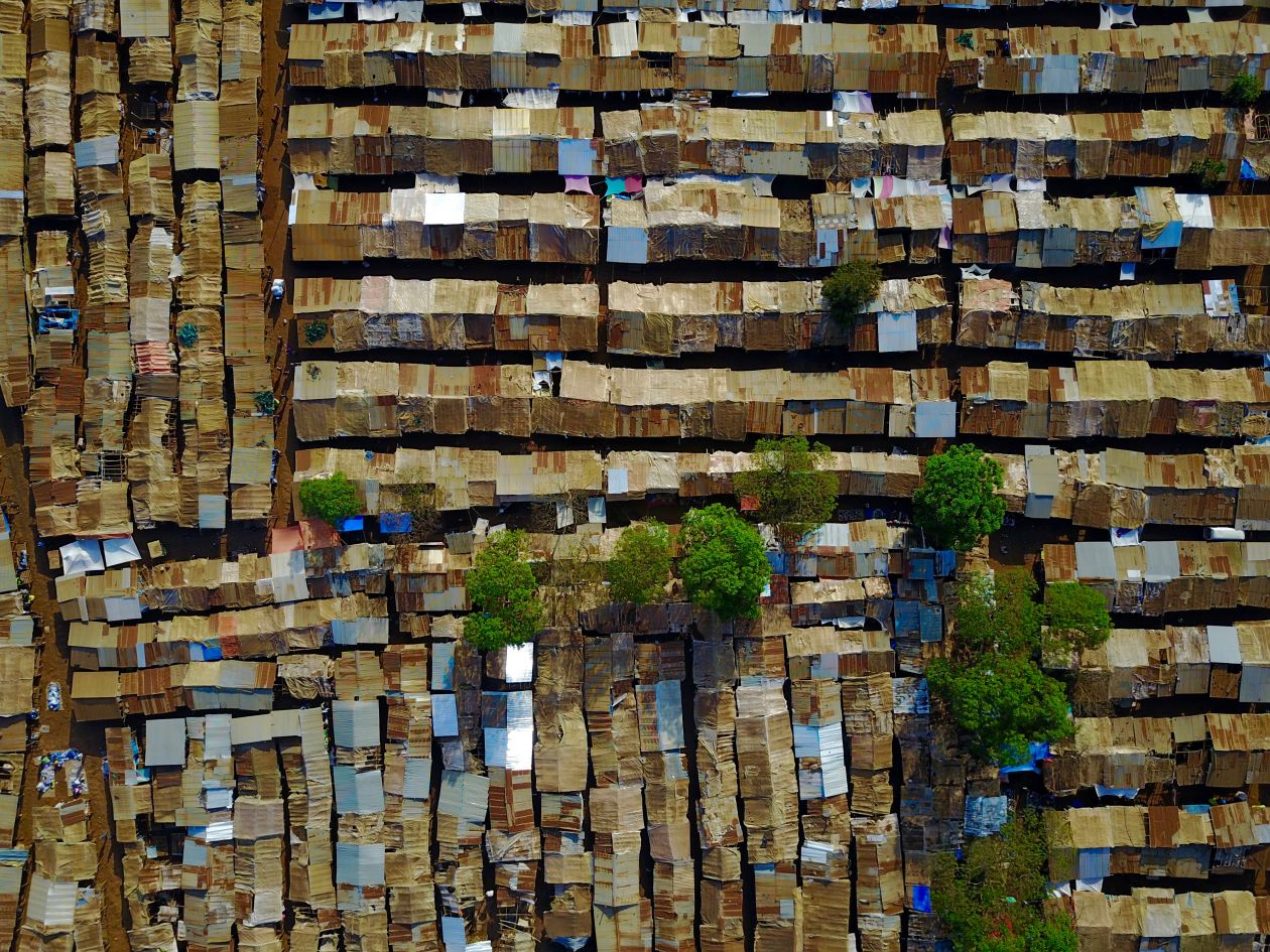
Aerial footage captured by a drone displays a unique perspective of a shanty town, providing a view of the makeshift shelters and dwellings from above. The chaotic arrangement of the small temporary structures surrounded by urban sprawl offers a stark visual reminder of the stark economic disparities present in many developing countries. The rooftop aerial view offers a glimpse into the complex dynamics of informal settlements, where residents often live in substandard conditions without access to basic amenities such as clean water and reliable electricity. The use of drones to document these areas not only allows for an unprecedented aerial view but also raises important questions about urban planning, poverty alleviation, and social inequality. By highlighting the plight of those marginalized communities, such visual storytelling has the potential to spark conversations and drive change towards creating more inclusive and sustainable cities for all. The juxtaposition of the drone’s perspective with the surrounding landscape gives a powerful illustration of the challenging living conditions faced by many residents in shanty towns around the world. This aerial documentation can serve as a catalyst for advocating for improved living conditions, increased access to resources, and better opportunities for those residing in such areas. recognizing the human stories behind the aerial view of shanty towns moves discussions beyond mere statistics to a more empathetic understanding of the daily struggles faced by individuals living on the margins of society.